1-1500h.png)
-1500h.png)
-1500h.png)
Scan to Download


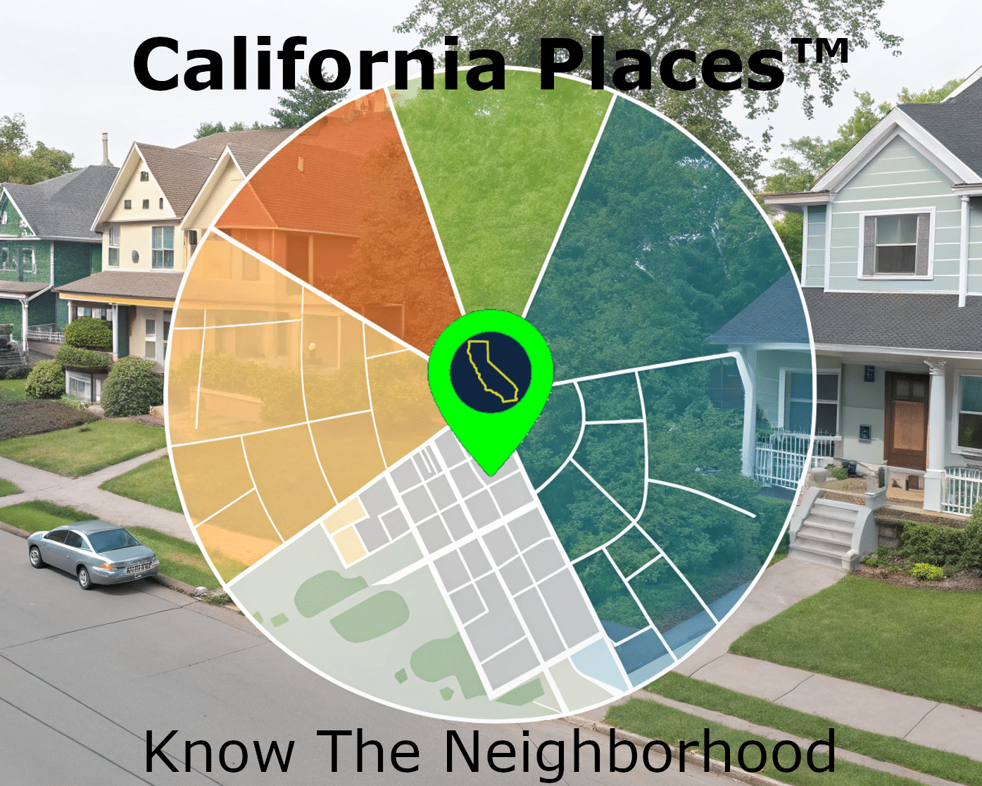
Drill Down With An Expansive Feature Set
- Owner Information
- Deed History
- Zoning Information
- Waste/Recycling Providers
- Elected Officals
- Government Dept. Info
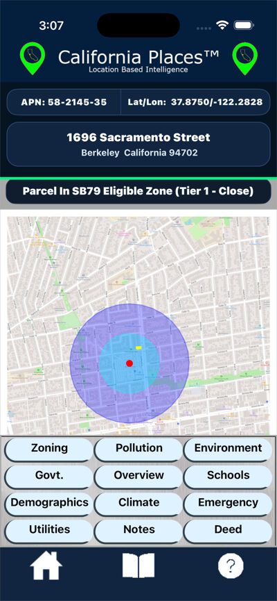
- SB79 Eligibility
- USDA Plant Hardiness zones
- Traffic
- Nearby Well Completion Reports
- Tap Water Quality Reports
- Powerline Proximity
- Plus Much more...
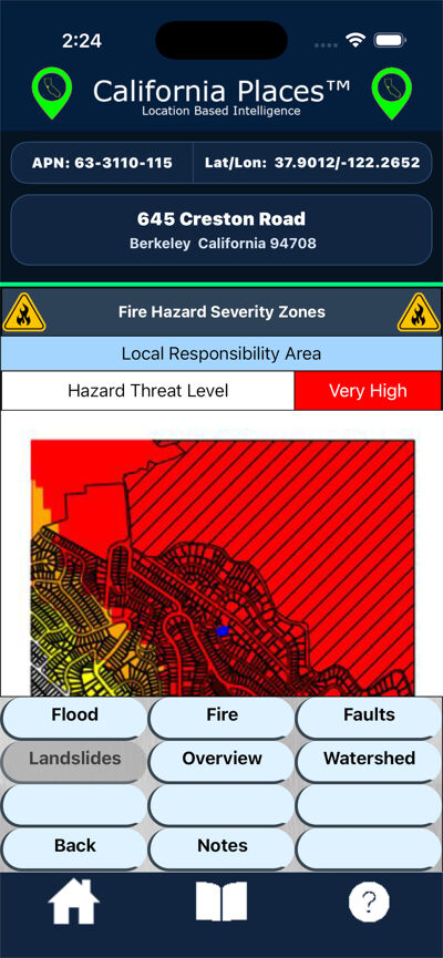
- Fire Hazard Zones
- Flood Zones
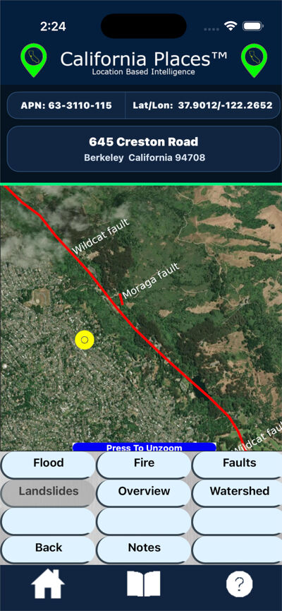
- Seismic Hazards
- Summertime Fog/Low Cloud Avg. Hrs.
- Tract/Block Group/Block Demographics
- Census Age/Income Data
- Census Ancestry/Race Data
- Public Schools Testing Info
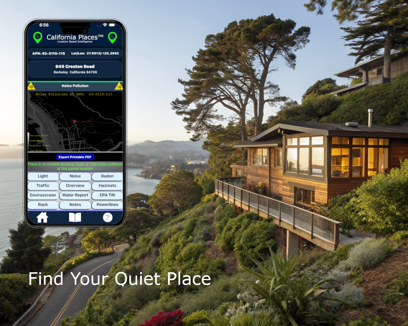
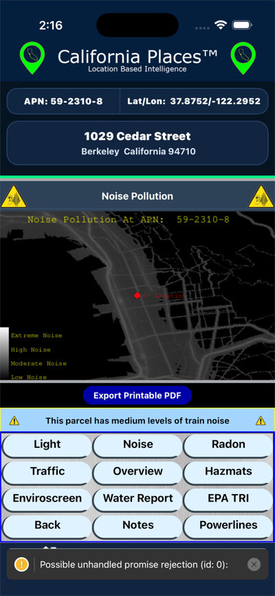
- Noise/Light Pollution
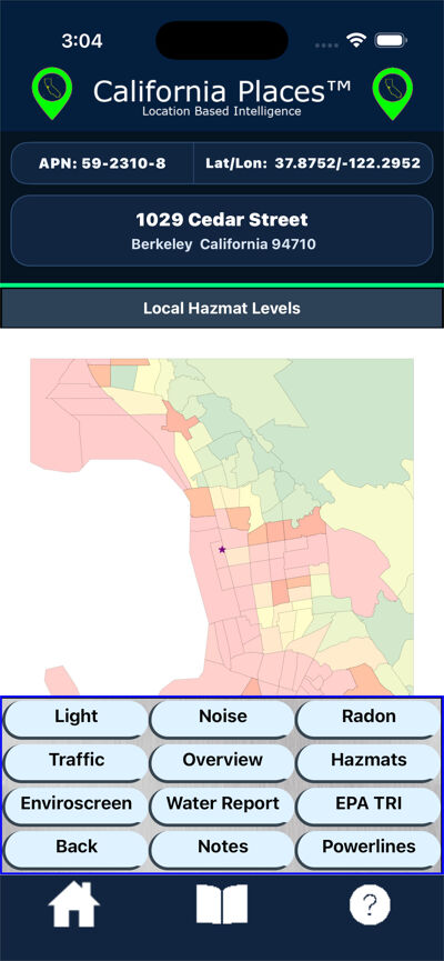
- Local Hazmats/Toxic Releasers
- Groundwater Threats
- Air Pollution
- Plus Much More...
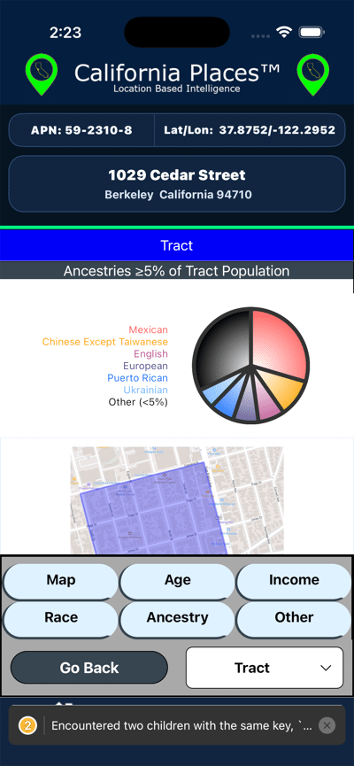
Demographics
Down to nearest block.
- Age
- Income
- Ancestry/Race
- Other
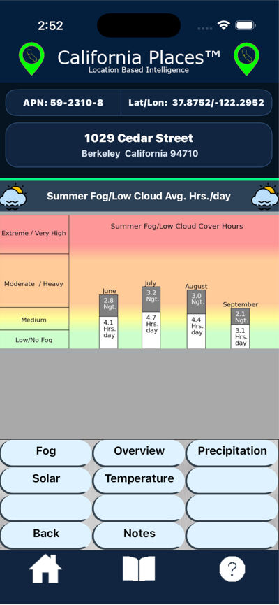
Climate
- Summer Fog Hours
- Historical Temps/Precip
- Plant Hardiness Zones
Environmental Risks
- FEMA Flood Zones
- CalFire Hazard Map
- Fault Line Proximity
- Dam Breach Inundation Zones
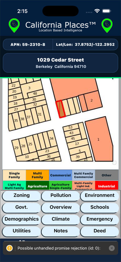
Zoning
- Nearby Hazmat Facilities
- Noise/Light Pollution
- Water Quality
- Nearby Toxic Releasers
Pollution
- Nearby Hazmat Facilities
- Noise/Light Pollution
- Water Quality
- Nearby Toxic Releasers
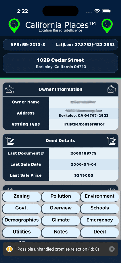
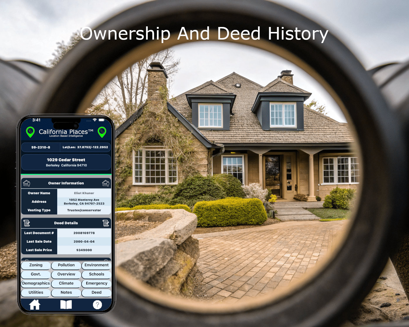
Owner And Deed History
- Owner Address
- Last Sales/Transfers
- Tax Information
- Price History